
Ponca City ZIP Code Coverage
Official USPS material identifies three ZIP codes in the Ponca City group: 74601, 74602, and 74604. That is the verified group, not a neighborhood map or a count of every address within city limits. The local source reviewed does not assign exact neighborhoods, rural pockets, or parcel-level boundaries to the three codes. Each real address should be checked through USPS before it is used in a Kay County property, permit, or court search.
| ZIP | Areas covered | Post office | Notes |
|---|---|---|---|
| 74601 | Ponca City USPS group and standard city-delivery context | Ponca City Post Office, 402 E. Grand Ave., Ponca City, OK 74601-9998 | Use a USPS address result for exact delivery and neighborhood context. |
| 74602 | Ponca City USPS service designation | USPS group listing | Exact street versus PO-box coverage was not exposed in the official source reviewed. |
| 74604 | Ponca City USPS service designation | USPS group listing | Exact neighborhoods, rural pockets, and city-line differences were not located in official USPS text. |
The official USPS DMM ZIP-group listing is the source captured in this Ponca City ZIP code directory image.
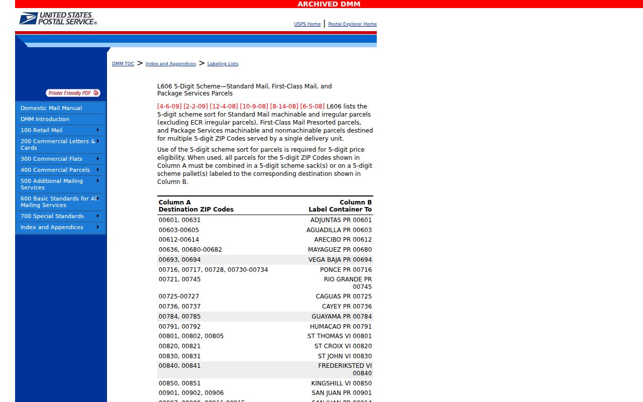
The group listing confirms the three codes, but it does not supply a parcel-level map. No verified official source located 74603 as another Ponca City ZIP, so it should not be added from an unverified directory. The Ponca City Post Office listing places the main office at 402 E. Grand, with retail service Monday through Friday from 9 a.m. to 5 p.m. and Saturday from 10 a.m. to 1 p.m., phone 580-762-2870. That contact answers delivery questions, not ownership or occupant questions.
Ponca City ZIP Code Verification
Use USPS before copying a ZIP into another record search. The official lookup has three modes: By Address, By City and State, and Cities by ZIP. By Address is the strongest choice for one property because it normalizes the delivery form. It requires street address, city, and state. Company, apartment or suite, and ZIP are optional, but a unit should be included when several delivery points share an address. USPS warns that its result does not confirm that a person or company is at the address.
| USPS mode | Required fields | Optional or result use |
|---|---|---|
| By Address | Street address, city, state | Company, apartment or suite, and ZIP are optional; use it to standardize one address. |
| By City and State | City and state | Use it to see USPS city-and-state results, not to identify a resident. |
| Cities by ZIP | ZIP | Use it to check postal city naming for a known code. |
The USPS ZIP Code Lookup appears in this Ponca City ZIP code directory image.
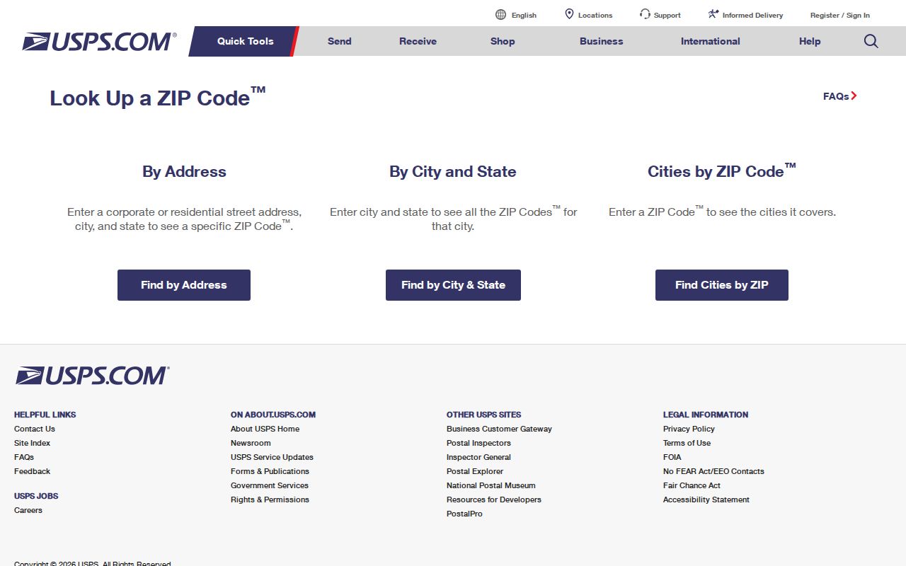
Write down the standardized street number, directional, suffix, unit, city, state, and ZIP that USPS returns. Then use only the fields the next custodian documents. A postal lookup is the address-normalization step. It is not a resident roster, a city-limit decision, or a substitute for a Kay County parcel record.
Search a Ponca City ZIP
A ZIP can narrow an address task, but no verified Kay County portal provides a public ZIP-wide list of residents or parcels. The useful workflow begins with one known address. It then follows the address into county records that use a parcel or legal description. This preserves the difference between a postal code and a government record key.
- Run USPS By Address with the street, city, state, and any unit. Save the normalized delivery form and ZIP.
- Search the Kay County actDataScout property search by documented address, owner, account, parcel, subdivision, township, range, or section. ZIP is not a documented search field.
- When a rural, irregular, or changed address does not resolve, contact Kay County Mapping for E-911 addressing assistance using the parcel, legal description, road access, or neighboring addresses.
- Use the parcel's legal description in the Kay County land-record index for a deed or plat. The modern index begins in January 1973; historical series use a different index route.
- For a dated city project, use a main address or parcel with Building Services or the city archive, not a ZIP alone. A street-level task can then continue through the Ponca City street directory.
For a historical ZIP-area question, search library directories and newspapers by street or address, then bridge the older form to a modern parcel. Historic books did not use ZIP codes as their organizing key, so a 1924 address should not be searched as though it were a modern postal area.
Ponca City ZIP Filter Limits
USPS accepts ZIP information in its address and city modes. The local public-record systems do not offer the same filter. The Kay Assessor documents account, parcel, address, owner, subdivision, township, range, and section, but not ZIP. The modern Clerk land portal does not expose ZIP in its advanced field list. The Oklahoma Voter Portal requires first name, last name, and date of birth, while the Mapping page does not expose a public ZIP layer. Those limits prevent a reliable browse of everyone connected to one ZIP.
| Custodian | Documented input | ZIP-wide result? |
|---|---|---|
| USPS | Address, city/state, or ZIP mode | Delivery normalization only |
| Kay Assessor | Address, owner, parcel, account, subdivision, township, range, section | No documented ZIP input |
| Kay County Clerk | Party, instrument, date, and legal-description fields | No exposed ZIP advanced field |
| Oklahoma Voter Portal | First name, last name, and date of birth | No public ZIP-browse field |
A person seeking an existing ZIP-area extract should ask the relevant custodian for that existing record and expect privacy, fees, and no-custom-report limits. The Oklahoma Open Records Act does not require an office to assemble a new ZIP-based directory from separate systems.
ZIP Codes Outside Ponca City
ZIP codes are postal delivery designations, not municipal boundaries. USPS says ZIP codes do not adhere to city limits. A Kay County parcel can carry a Ponca City mailing address without being inside the incorporated city, and a city decision may depend on the legal boundary rather than the postal name. Newkirk is the county seat even though Ponca City is Kay County's largest city, which is another reason to separate city offices from county custodians.
City-limit check. A Ponca City mailing ZIP does not establish city jurisdiction. Confirm the parcel or map context with the county and the relevant city or county office before relying on a ZIP for permits, taxation, voting districts, or court jurisdiction.
Census ZCTAs are different again. A ZCTA is a statistical geography created for Census data, not a USPS delivery boundary. A profile for ZCTA5 74601 can support careful statistical research, but it cannot prove the exact extent of the 74601 delivery area or city incorporation. No official local ZIP population table was located for 74601, 74602, or 74604.
Ponca City Parcel Bridges
The durable bridge from a postal address to a land record is usually a parcel and legal description. A street number can be changed, omitted, rural, or paired with a different mailing ZIP. Kay County mapping uses deeds, surveys, and plats to maintain parcel and E-911 addressing information. The Assessor can confirm whether a property card's situs address, tax mailing address, parcel ID, and legal description point to the same place before a Clerk search starts.
- ZIP+4
- An added postal delivery segment that standardizes delivery, not a city-limit boundary.
- ZCTA
- A Census statistical approximation of ZIP-area geography, not a USPS delivery boundary.
- Situs address
- The physical location of a parcel. It can differ from the owner's tax mailing address.
- Legal description
- The deed's land identifier, often addition, block, lot, or section, township, and range. It is the durable link among plats, deeds, and parcel records.
For a confused address, call the Kay County Mapping Department at the Assessor's office. New-address work can use owner or resident name, road access, parcel ID or legal description, or neighboring addresses. That service resolves physical-location questions; it is not a public household directory.
Ponca City Tax Map Caution
Kay County reports 30,377 parcels across eight municipalities and about 921 square miles. That scale explains why a familiar Ponca City mailing label can still require county-level parcel and mapping work. County tax maps are public, but they are expressly for tax purposes only and do not convey title. A visible parcel shape is a geographic starting point, not proof of ownership, occupancy, a ZIP boundary, or a city-limit ruling.
The Mapping Department updates information for sales, subdivisions, redistricting, and road changes from deeds, surveys, and plats. A direct public GIS viewer URL, public ZIP layer, parcel-click instructions, and radius tools were not located in official research. Ask staff for the appropriate map or data assistance instead of assuming an online map can perform a ZIP-wide resident search.
Ponca City ZIP History
Modern ZIP codes do not organize older Ponca City records. The documented local directory runs include 1924, 1926, 1930, 1932, 1938, and 1940, while historical Sanborn material predates the current postal framework. To trace an old street into a current ZIP, preserve both forms of the address: numeric or spelled-out street name, directional prefix, apartment or unit, old addition name, and any rural-route wording. Then use the parcel or legal description to join the historic and current versions.
Search an older address in the Oklahoma Historical Society home-history route, local directories, deeds, plats, Sanborn maps, and newspapers. A historic directory can document a person or business at a dated address, but it cannot confirm a present resident. No official citywide ZIP realignment or street-renumbering date was located, so each address change needs record-by-record confirmation rather than a guessed conversion rule.